. Portrait of Louis XIV (detail), 1662. MV 5930. Photo: Franck Raux. Châteaux de Versailles et de Trianon, Versailles, France. Photo Credit: Réunion des Musées Nationaux / Art Resource, NY | Map of northen America…(detail), attributed to Claude Bernou, 1681, Cartes et plans, GE SH 18E PF 122 DIV 2 P 0 RES, Bibliothèque nationale de France")
-
- Introduction
- Colonies and Empires
- The Explorers
- Jacques Cartier 1534-1542
- Samuel de Champlain 1604-1616
- Étienne Brûlé 1615-1621
- Jean Nicollet 1634
- Jean de Quen 1647
- Médard Chouart Des Groseilliers 1654-1660
- Pierre-Esprit Radisson 1659-1660
- Nicolas Perrot 1665-1689
- René-Robert Cavelier de La Salle 1670-1687
- Charles Albanel 1672
- Jacques Marquette 1673
- Louis Jolliet 1673-1694
- Louis Hennepin 1678-1680
- Daniel Greysolon Dulhut 1678-1679
- Louis-Armand de Lom d’Arce, baron Lahontan 1684-1689
- Pierre de Troyes 1686
- Pierre Le Moyne d’Iberville 1686-1702
- Antoine Laumet dit de Lamothe Cadillac 1694-1701
- Pierre Gaultier de Varennes et de La Vérendrye 1732-1739
- Economic Activities
- Population
- Daily Life
- Heritage
- Useful links
- Credits
Colonies and Empires
North America Before New France
Almost 11,000 years ago, Natives from the south began exploring the territory that would become, in the modern era, New France. The arrival of these men and women in what would much later be known as North America marked the beginning of human settlements on land that, up to that point, had been entirely covered in ice.
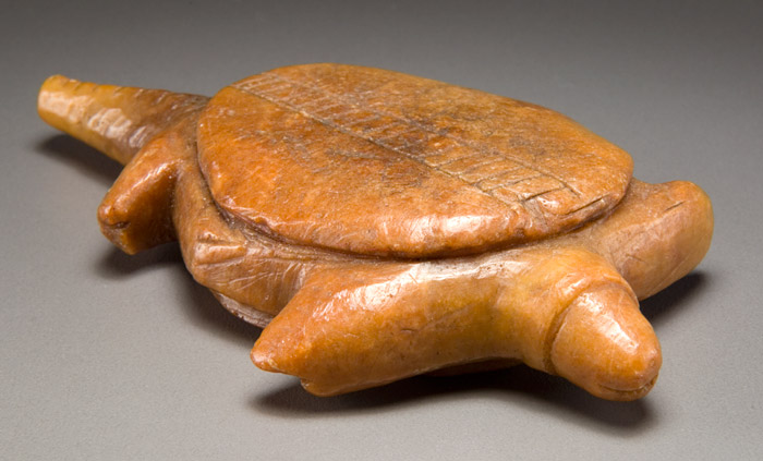
Turtle effigy
In this fascinating article, Michel Plourde reveals a widely unknown facet of the history, or rather, the prehistory of New France. He takes the reader on a journey to discover the various Native civilizations that inhabited the main settlement areas of New France – Acadia, the St. Lawrence Valley and Louisiana – during the millennial that preceded the arrival of the first European settlers.
By using the latest archaeological data, the author introduces us to these peoples, the early ancestors of the Iroquois, Huron, Innu and Natchez, and highlights the cultural differences that existed amongst them in terms of, for example, social organization, economy and lifestyle.
The reader may be surprised by the evolution of their ways of life and cultures, as well as the major changes that occurred in their societies, such as in their diet, during the last millennial of the period we call “prehistoric.”
New France: an Aboriginal territory dating back 11,000 years (show)
Archaeological research that was done in the “Canadian heart” of New France revealed quite varied settlement areas, which attest to the adaptation and development of different Native communities in a physical environment that was quite contrasting. Coming from the south, the first human populations travelled across the territory as of 11000 BP and settled there, as fauna and flora began covering the areas that had been opened up by melting glaciers – BP corresponds to “Before Present,” i.e. the number of years before the year 1950 of the Common Era. These populations, which were named “Paleo-Indian” by archaeologists, adopted a highly nomadic lifestyle. They were not only skilled in caribou hunting, but were also excellent stonecutters who favoured silica-rich varieties to fashion, for instance, fluted points, spokeshaves, drills and beaked scrapers. Their journeys across the territory were most likely planned so as to follow herds of big game, while ensuring access to the main stone quarries. The sites of Debert, Nova Scotia, and Mégantic, Québec, are the most well known.
From 9000-8000 BP until 5000 BP, following a period of climatic warming, the subarctic environment was replaced by mixed-wood forests and the caribou herds migrated north. Archaeological sites reveal that the old chert quarries were abandoned in favour of inferior material, such as quartz and metamorphic stone. Native groups thus began to reduce their travels and focus their activities around the same areas. The broad stone points were likely replaced by tools made from antlers and bones (which are rarely preserved in the ground), and a wide array of rudimentary cutting and grinding tools appeared. In addition, a new stone-polishing technique allowed them to make axes, adzes and gouges. All types of environments were then exploited, notably near the rivers and swamps of the interior, which somewhat helped the Natives lessen the frequency of the long and continuous journeys across the territory that were required for caribou hunting.
Around 5000 BP, the Native populations who inhabited the Lower St. Lawrence and Great Lakes regions continued to hunt, fish, trap and gather plants, small fruit and molluscs. These “Laurentian Archaic” peoples further utilized the territory and made use of several varieties of stone, such as greenish Appalachian chert, white quartzite from the Canadian Shield and bluish chert from the Niagara Peninsula. From these raw materials, they crafted notched points, scrapers, knives and drills of various sizes. They refined their polishing techniques and made extraordinary points, axes, gouges and weights for fishing nets and atlatls, as well as bayonets. Many objects were made out of bone for fishing, while copper extracted from outcrops located in, notably, Lake Superior, was used to make an assortment of tools and ornaments that was as varied as the ones made of stone. The use of milling objects, such as grinding wheels, also illustrates the transformation of vegetable matter for consumption. The increased number and geographical dispersion of the sites, as well as the increased use of local, raw lithic material show a growth in population, a reduction in developed territories and a decline in travelling. These groups also embraced funeral traditions that were characterized by the use of red ochre and mortuary offerings of a quality that highly surpassed that of everyday objects.
Shortly after 4000 BP, there were several changes in the northeast in terms of types of tools, settlement patterns and funeral traditions, which seems to indicate a strong ideological influence from the southern Susquehanna people. The cultural geography that would later be described by the first European settlers was already visible around 3000 BP. In the Maritimes, the Proto-Malecite/Micmac/Passamaquoddy continued to occupy the territory and make use of its resources the way their predecessors did. These populations, several of whose coastal sites are now under water, added two innovations to their daily lives: the bow and arrow, and pottery. In the St. Lawrence Valley and Great Lakes regions, the people known as Point Peninsula/Meadowood/Saugeen also embraced pottery, as well as a new carving style called Meadowood, which was used on lithic material from the Niagara Peninsula called Onondaga chert. The use of tobacco, new polished-stone instruments (gorgets, bird-stones, tube pipes), copper ornaments and highly elaborate funeral traditions also marked this period. Although rarely heard in the Maritimes, these manifestations did coincide with the development of Proto-Algonquian languages on the Micmac, Malecite and Abenaki territories.
The turn of the Common Era marked the first attempts at horticulture in a context where several communities had already chosen a semi-sedentary way of life, thanks to abundant fishing and an extended knowledge of the forest’s plant resources. Pottery was omnipresent, and tapered vessels, entirely decorated with wavy or saw-like lines, were soon replaced with globular ones. These vessels were surface treated and decorated strictly on the upper part, sometimes only the collar, which was quite innovative. Trading networks reached their peak; shark teeth from the Gulf of Mexico, seashells from the Atlantic coast, obsidian from Wyoming and steatite pipes made in Ohio ended up in the hands of the inhabitants of the northeast.
The last millennial of the prehistoric period was marked by a major change in the way the Natives obtained food. Although they still hunted, fished, trapped and gathered, they eventually turned to farming. Corn, squash, sunflower and tobacco were not only grown and eaten, but also stockpiled and used as trading currency. Their dwellings, which usually housed one or two families, stretched over several metres. Farming vegetables also allowed them to become more sedentary, and the number of individuals who could live the whole year or almost in the same place increased tenfold, reaching up to 2,000 people.
The populations living near the Atlantic, like those in the coniferous forests, did not take part in this food revolution to the same extent, continuing instead to exploit land and water resources. In fact, some refuse pits contained significant quantities of mollusc shells, which attest to longs stays on the coast. Sailing on the high seas became second nature to the Micmac; using boats that could measure as long as nine metres, these canoeists would cross the 90 kilometres separating Cape Breton (Nova Scotia) from the Magdalen Islands, as illustrated by the similarities in material discovered on sites in these two regions.
Algonquian and Iroquoian
When the first European explorers arrived, the northeast North-American continent was inhabited by two major linguistic and cultural families: the Algonquian and the Iroquoian.
The Algonquian groups were the most numerous. Although they spoke similar languages, their ways of life varied widely, depending on their environment. For example, the coniferous and Laurentian forests that stretched from the Maritimes to the Western Prairies were frequented by bands of nomadic hunters-gatherers; while these familial bands got together in the summer on coastal or riverside sites, they would break up and scatter across the interior in the winter.
The Algonquian peoples who inhabited the area stretching from the southern Great Lakes to the Mississippi basin, as well as the coast of the Atlantic to the Carolinas, had a more sedentary way of life, living in villages and practicing farming.
The Iroquoian language groups, for their part, occupied the Lower St. Lawrence Valley, the southeast portion of the Great Lakes region and the northern part of modern-day New York State. Their way of life was definitely more consistent than the Algonquian; they practiced farming and were semi-sedentary, and their villages moved every 15 to 30 years. The Iroquoian also distinguished themselves by their matrilineal family structure, meaning that individuals followed the lineage of their mother, not their father.
The Maritimes (show)
Prehistoric Acadia was inhabited by Algonquian groups. The Passamaquoddy in southeast New Brunswick and Maine, the Malecite in the drainage basin of the St. John River, and the Micmac in northern New Brunswick, Nova Scotia, Prince Edward Island and parts of Gaspésie shared some linguistic characteristics that made them part of one large family, named Eastern Algonquian.
Territory, mobility and social organisation
The Algonquian who inhabited the Maritimes dwelled in four types of environment: the seashore, the offshore islands, the riverside upstream of the limits of high tide, and the lakes and rivers of the interior. They moved often and did not always have a fixed schedule. For some, winter was spent along the coast to hunt seals, for example, while others preferred spending the cold season in the interior, hunting caribou. Such conditions would not have permitted the establishment of a social hierarchy, as opposed to the communities of the Western coast of Canada, for example. The exploitation of fine-grained stone, which was carved or polished to create a multitude of tools, was another reason to move from place to place. Indeed, they often went directly to the quarries or took part in a vast supply network. For instance, groups on the Atlantic coast acquired greenish chert from Lake Touladi, in Témiscouata, and burgundy chert from Lake Munsungun, in northwest Maine, while brightly coloured chert from the Bay of Fundy, Nova Scotia, was traded as far as the Appalachians and the St. Lawrence Valley. There was also imported quartzite extracted from the Bay of Ramah in northern Labrador and the Mistassini sector, and Onondaga chert from the confluence of lakes Erie and Ontario. The Micmac, for one, could travel long distances at sea, like the hunters of Cape Breton who travelled to the Magdalen Islands.
The Algonquian societies of the Maritimes are considered to be fundamentally egalitarian, as archaeological data does not reveal any specific hierarchy. The Micmac, for example, practiced exogamy, which ensured marriages between different communities. Patrilocal bands named a male chief who actually had limited powers. Villages were composed of six nuclear families, i.e. about 30 people, who would split into smaller groups and meet again as they travelled across the territory.
In general, sites were occupied by a few families, who returned year after year. Larger seasonal gatherings were held in estuary areas, where everyone could benefit from abundant resources. These places, located at the crossroads of major waterways, were in fact crucial meeting spots; they were easy to access by canoe, close to a source of drinking water, bathed by the sun and protected from cold winds. An open fire pit, consisting of a stone platform measuring about a meter in diameter, was used to cook food and keep occupants warm in a round or oval tent of about four metres in diameter. Food reserves were kept in storage pits in preparation for winter’s harsh conditions; one site along Miramichi River, New Brunswick, counted up to 60 of them. Some houses were even built half a metre into the ground. In addition, Jesuit writings from the 17th century mention an insulation technique to ward off the cold that consisted of building the walls of a house with two layers of birch bark separated by a layer of moss.
Eating habits
The coast featured a wealth of animal resources, such as sea mammals, saltwater and freshwater fish, migratory birds and molluscs, which were exploited in different seasons, depending on their abundance or availability. Nets were set at the mouths of rivers to catch salmon, while cod was fished off the coast. Dams made out of wood posts were also used to catch fish, in areas uncovered at low tide and at lake outlets. Tidelands were full of molluscs (oysters and quahogs), which were pulled from the mud by the hundreds. And when these species were scarce, Native groups would travel inland along the rivers and hunt beaver or moose. Dogs also helped track moose and detect the presence of beavers in their lodges. Unfortunately, the remains of crustaceans, sweet berries, nuts, farmed plants, such as corn, or wild varieties, such as fiddleheads, have almost never been preserved on archaeological sites, even though they were part of the Native diet. Mammal bones were split open or crushed to extract their marrow, which was rich in protein.
Material culture
The Native material culture that was preserved in the ground consists of clay pots, projectile points that were notched at the base (which illustrate the use of the bow and arrow, and which differ from the broader points that were used as spears), coin-sized scrapers, bifacial knives of various sizes, adzes made of carved or polished stone, and many flakes, the waste product from stone carving, whose sharp edges made them great throwaway knives. Animal bones, teeth and ivory provided the ideal raw material for knives with arched blades (beaver teeth were one example), harpoons with detachable heads, needles and awls. The clay pots that were once decorated with comb-like patterns were later adorned by using a stick wrapped with a fibre cord; this innovative style actually swept through the entire American Northeast. Surprisingly, the fabrication of vessels was less refined than before; contrary to the peoples of the Great Lakes and the St. Lawrence Valley, who fashioned their pots from a lump of clay, vessels were still made by stacking coils (which made them more fragile). Crushed shells were combined with clay to make such pots, eventually replacing granite as tempering material. It is possible that the technique for making clay vessels became less refined due to the use of tree-bark pots. Unfortunately, the ground’s natural acidity was often harmful to objects made of organic matter, but an exceptional discovery in Pictou, Nova Scotia, did unearth a fibre-impressed artefact.
The St. Lawrence Valley (show)
When Jacques Cartier explored the St. Lawrence in 1535, Iroquoian groups lived in camps and villages in an area that stretched from the mouth of the Saguenay River to the Great Lakes. They spoke a language that was different from other Iroquoian groups encountered by Europeans elsewhere in the American northeast, such as the Onondaga, Mohawk, Oneida and Huron, for example. No one knows for sure when they arrived in the St. Lawrence. Some believe that their way of settling and living off the territory, as well as their pottery and lithic techniques, can be seen starting in the fifth century C.E. Others believe that because this continuity is not significant enough on archaeological sites, we can only truly date the establishment of these peoples to the 14th century. This question is still not resolved. As for the part of the St. Lawrence Valley located downstream of Québec, it is presumed that it was frequented by the ancestors or predecessors of the Innu (Montagnais), Malecite and Micmac, and that the Iroquoians of the St. Lawrence would go there on seal-hunting and mackerel-fishing excursions. The nature of relations between these groups before the French occupation is still, unfortunately, not known.
Provinces, villages and households
Exploring the St. Lawrence Valley, Jacques Cartier recognized two groups who inhabited about 10 villages scattered between Lake Saint-Francis and île-aux-Coudres: the Hochelagan, in the Montréal region, and the Stadaconan, in the Québec region. These were apparently two confederations, each composed of related tribes.
Archaeological studies, however, have revealed at least four Iroquoian provinces, or cultural groups. Jefferson, the first, stretched across the counties of Jefferson and St. Lawrence in the state of New York. The second, Hochelaga, included the island of Montréal and the region reaching to Prescott. It is there that archaeologists found the largest villages, such as Roebuck, Ontario, which covered 3.2 hectares. The third, Maisouna, was located between the Assomption River and the present-day village of Lanoraie, Québec, while the fourth, “Canada”, covered the territory between Portneuf and Île aux Coudres and may even have reached the mouth of the Saguenay. This last province included seven smaller villages that were not protected by palisades, all located on the north shore of the river. The county town of Stadacona, the capital of the province of Canada, would today be found within the limits of Québec City. Jacques Cartier wrote:
“[…] there are four peoples and habitations: Ajoasté, Starnatan, Tailla, which is on a mountain, and Sitadin. Then said site of Stadacona […]. Past said site are the people and habitations of Tequenonday and Hochelay; Tequenonday is on a mountain and the other on flat land” (Bideaux 1986: 166). [Loose translation]
This site would therefore correspond to their settlement territory. Based on the demographic density of 17th-century Huron villages and on estimates generated during digs in the Iroquoian villages of Mandeville and Masson, the population of this cultural province was estimated at between 2,000 and 3,000 people. Stadacona would have been home to some 800 individuals, while the three villages to the east would have counted an average of about 200 to 250 inhabitants.
Contrary to the conglomerations of villages in the northern state of New York and eastern Ontario, which served as protection against enemies, the Iroquoian conglomerations of the St. Lawrence were fairly distanced from one another. This seems to indicate that there were no hostilities, except in the estuary, where the Micmac were a threat. The sites were usually located on well-drained sandy or silty soil, often set back from the river, on former terraces or morainic ridges, like in Saint-Anicet. A major fishing site was uncovered in Pointe-du-Buisson, across from the Beauharnois rapids.
Farming definitely contributed to the adoption of a more sedentary way of life by those who gathered in medium-sized conglomerations: Roebuck and Saint-Anicet, in the Upper St. Lawrence; Tracy, along the Richelieu; and the north shore of the St. Lawrence, in Lanoraie and Deschambault. Villages were composed of large longhouses, which measured six to seven metres and featured a row of hearths and small pits. Family relationships between Iroquoians, as well as their residential models, were based on a matrilineal system. Indeed, family lines were passed from mother to daughter instead of father to son, and newlyweds would move in with the bride’s family, not the groom’s.
Houses were built on a frame of posts, with sections dug into the ground that sometimes left vestiges. Refuse pits were often dug into a hill near the houses, and there was usually a cemetery outside the village. Some villages were surrounded by a palisade. These were semi-permanent settlements that were located near good fishing spots and had at least 130 days without frost. When the soil became depleted due to farming, or if firewood became scarce, for example, a village would have to be relocated (every 15 years or so). In addition, a fallow period of approximately 50 years was required for farmland to regenerate naturally, so a village had to be moved four or five times before it was rebuilt on a former settlement.
Nutrition and health
Along the river between Montréal and the Great Lakes, corn, squash and sunflower farming marked a veritable food revolution that began in the early 14th century, possibly after several centuries of experimenting. These plants were grown in clearings around the dwellings, although some have been found over a kilometre away from the villages.
Corn
The history of sedentary and semi-sedentary Aboriginal peoples is closely linked to the history of corn, or zea mays. The emergence of this cereal was the result of a mutation in a wild, ear-producing plant and a long process of domestication that began about 5,500 years ago by the Natives of southwest Mexico. Gradual mutations then led to the progressive selection of varieties that were the most productive and the most suitable for farming.
Corn was gradually spread throughout America. Some 3,000 years ago, it reached present-day New Mexico and Arizona. Although the first archaeological traces of corn appeared in the Great Lakes region around the year 100 C.E., it was only in the year 500 that it found its place at the heart of the region’s Iroquoian diet.
To date, over 5,000 varieties of corn have been identified. For the Iroquoians of the St. Lawrence, the most abundant type was zea mays indurata, also known as Northern Flint. It was named after its hard outer layer, which makes the kernels very hard and shiny. It matures quickly, in about 100 days or so, which was a significant advantage in these regions, where the warm season was short-lived.
Seeding and harvesting were done by hand, and kernels were then dried. To release the nutritional elements of the hard-kernel varieties of corn, an alkaline substance, such as crushed limestone or ashes, was added when the corn was ground or prepared. Since it was easy to produce and preserve, corn was ideal for accumulating food reserves on which the village communities depended.
Hunting, fishing and gathering were still practiced, and wild meat counted for about 20 to 30% of the caloric intake. For optimal deer hunting, a pen was made by shaping posts into a “V”, towards which small herds would be led. East of Montréal, however, people sought fish, eel, various mammals and birds, as well as seals, so farming only played a secondary role. While women were responsible for maintaining the corn, squash and sunflower fields, men were in charge of cultivating tobacco, which was done quite a distance from the fields, and even near the longhouses.
Once abandoned, cornfields were replanted with nut trees, such as oak, white walnut and hickory. Thanks to their oil-rich nuts, they were highly sought after as secondary food sources. Many wild plants, such as sumac, raspberries and strawberries, were also consumed.
Analyzed human remains revealed various pathologies, such as tuberculosis, tooth cavities caused by eating corn, and even cancer. Some cases of femoral torsion in women also show that heavy loads were always carried on the same side of the body.
Material culture
The material culture of the St. Lawrence Iroquoians was characterized by pottery (mostly vessels and pipes), a wide array of bone tools, axes of polished stone and grinding stones. Pottery was not created by a class of craftswomen, but rather by each maternal line; indeed, techniques were transmitted from mother to daughter. Vessels were often decorated with complex patterns that defined a very specific regional style. They were characterized by a globular body and a narrow neck topped with an open collar and a castellation. The collar was decorated with a variable geometric motif that formed complex combinations, paired with circular punctures and series of notches. The most spectacular vessels were adorned with stylized human figures, while others displayed patterns reminiscent of a corn ear or a ladder.
Pipe making was a man’s activity. Iroquoian pipes often displayed exceptional artistic talent; their bowls were sometimes decorated with human figures, animal heads or both, which were placed so as to face the smoker. Some pipes were shaped like trumpets and decorated with short horizontal lines on the outside of the bowl or punctures inside it. Other clay objects included beads and playing tokens.
People used stone shards to cut, scrape or dig. Cultivated plants were ground into flour or crushed with hand grinders; wood was carved with axes of polished stone, and many bone tools were sharpened on coarse-grained stones. Lithic tool-making was relatively rare, but this was compensated by the use of animal bones, which were transformed into awls, fishing hooks, projectile points, harpoons, spatulas, tattoo or plaiting needles, and handles. Beaver teeth were transformed into chippers; finishing implements were made of antlers to polish stone tools, such as points and scrapers, and phalanges were pierced to fashion cup-and-ball toys and pendants. They also used parts of very straight bones that were tapered at the end to remove cornhusks, as well as deer scapula to make pipes.
The disappearance of the St. Lawrence Iroquoians
The Iroquoians encountered by Jacques Cartier in 1535 disappeared before the end of the century. In 1608, Samuel de Champlain searched for, but never found the villages described by his famous predecessor. Most researchers are united in their efforts to solve the mystery of the various disappeared Iroquoian groups of the St. Lawrence Valley between the passages of Cartier, in 1535, and Champlain, in 1608. Several factors have been suggested as the reason for this phenomenon.
One suggestion is the devastating impact of European-originated epidemics, but the lack of archaeological proof puts this particular explanation in doubt. Climatic factors have also been suggested to explain the decline of Iroquoian societies; from 1300 to 1850 C.E., the average temperature of the northern hemisphere dropped, and this “Little Ice Age” may have made farming precarious in the eastern St. Lawrence Valley. In fact, the Iroquoians living in the Québec region may have continued to depend on seals to satisfy part of their annual needs because the pinniped population would not have significantly decreased. On the contrary, colder temperatures may have even increased their presence upriver of the mouth of the Saguenay, thus reducing the travelling distance required to take advantage of this resource.
The conflicts that divided the St. Lawrence Iroquoians and their neighbours during the last centuries of the Woodland era may have also played a crucial role. The inhabitants of Stadacona told Cartier that they were at war with the “Toudamans”, to the east, while those of Hochelaga said they were fighting the “Agojudas” to the west. The first seem to correspond to the Micmac and the Malecite, but the identity of the second group is still undetermined; it might be one of the Iroquoian groups who lived in the Great Lakes regions, or even the Algonquin. The widespread expansionist efforts of the Five Nations Iroquois, notably the Mohawk, were also suspected. This scenario could explain the dispersion or withdrawal of the people of the St. Lawrence Valley. Neighbouring groups, such as the Huron, Mohawk or Algonquin of the Outaouais, would have taken them in as war prisoners or refugees and integrated them into their society.
Algonquians, Innu and Algonquin hunters-gatherers eventually filled the void left by the dispersion of the Iroquoian farmers of the St. Lawrence, and they were the ones who encountered Champlain on the Laurentian territory.
The Mississippi Valley (show)
In the Mississippi Valley, populations belonging to the Mississippian culture thrived between the ninth and 16th centuries. Experts usually subdivide this period into three stages. The Early Mississippi, from around 800 to 1000 (periodization varies from one region to another), represented a first transition phase, during which various populations abandoned the large tribal organizations that marked the Woodland era in favour of a sedentary lifestyle, intensive farming and political centralization. The Middle Mississippi, from 1200 to 1400 (in most regions), was the heyday of this new culture, when big cities flourished and the development of art and symbolism that characterized the era was at its peak. The late Mississippi, dating from 1400 to the first European contact, was marked by intense political and social turmoil, and, in the end, the dispersion of its populations.
Eating habits
While corn only reached the Great Lakes and the Upper St. Lawrence around the beginning of the 14th century, the food revolution began in the Mississippi Valley in the ninth century. Corn grew exceptionally well along the Mississippi and its tributaries because those regions boasted fertile soil and a mild climate. And since it supported a more numerous population, denser conglomerations and a specialized workforce, intensive corn farming led to the formation of several large cities and satellite towns.
The abundance of stone hoes found on archaeological sites illustrates the fundamental importance of farming in Mississippian life. In addition to corn, people cultivated squash, beans and sunflower. The rivers near the towns and villages were a source of fish, molluscs and other marine creatures such as turtles, which played a significant complementary role in the Mississippian diet. Hunting, especially deer, as well as gathering berries and nuts, were also important.
Occupation of the territory and social organization
Before the transition to the Mississippian stage, most of the region’s villages were small and only seasonally inhabited. But corn farming and demographic growth led to a diverse new mix of towns, villages, hamlets and isolated dwellings. The larger cities served as religious, political and administrative centres for the inhabitants of neighbouring satellites towns. Houses were square or rectangular, about 35 square metres, with walls that were often coated with plaster and thatched roofs, and they were usually lined up in an orderly fashion around the town square. Mississippian communities were also mainly characterized by the presence of rectangular platform mounds that could reach up to 30 metres in height, upon which sat temples, burial buildings and elite residences. In addition, a palisade or protective rampart usually surrounded the town.
Social hierarchy was more prominent in the Mississippian way of life than in the Aboriginal populations of the northeast. Indeed, control of political and religious power lay in the hands of the elite, or even of one individual. Chiefs, whose status seems to have been ascribed, governed the redistribution of food between satellite towns and large cities. They could mobilize a large part of the population for war or public works, as illustrated by the mounds, whose construction required a sustained collective effort. Although the state of their knowledge was still limited, the elite seems to have been responsible for both political and religious functions. It is likely that the chiefs oversaw the exchange of goods within their territories and with neighbouring territories, in addition to supervising the activities of a wide array of specialized artisans.
The most imposing and influential Mississippian city was Cahokia (near Collinsville, Illinois), which was inhabited between the years 600 and 1400. Located on a strategic site, near the confluence of the Mississippi, Missouri and Illinois rivers, it covered an area of nearly nine square kilometres and contained some 120 tumuli. Occupied by approximately 1,000 souls until the mid-11th century, Cahokia later saw its population increase exponentially, making it the largest urban centre north of the big Mexican metropolises. Archaeologists estimate that at its peak, the population of Cahokia was between 8,000 and 40,000 people.
Art and religion
Mississippian trading networks were continental in scale, which allowed the artisans of Cahokia and elsewhere to acquire exotic substances that specialized workers would fashion in their own style. Using whelk shells from the Atlantic Ocean or the Gulf of Mexico, they made small cups, gorgets, beads and all sorts of ornaments. With red argillite extracted from Missouri, they sculpted intricate statuettes and pipes, while copper nuggets from the Great Lakes were hammered into sheets, then engraved or embossed. Mill Creek chert, which came from southern Illinois, was redistributed throughout the Mississippian world and carved into axes, hoes and other tools that were prized for their durability. People also used local wood, clay and stones. Ornaments and vessels were often decorated with such figures as feathered serpents, winged warriors, spiders, human faces with tear-filled eyes or falcon eyes, human figures and an assortment of geometric patterns.
The material culture of the Mississippians, as well as the descriptions of the first European explorers, allow us to paint a picture of their religious traditions. The consistence of iconographic themes suggests a set of beliefs that archaeologists have named Southeastern Ceremonial Complex. Worshipping ancestors seems to have played a significant role; indeed, archaeological excavations unearthed kneeling figurines that were probably representations of elders. The members of the elite were buried below the burial buildings atop the mounds, surrounded by exotic ritual objects and sometimes by slaves or servants who were sacrificed in order to accompany their master to the hereafter.
The decline of the Mississippians
Even before the first European explorers reached southeast America in the 16th and 17th centuries, the Mississippian culture had begun to collapse. The people of Cahokia dispersed fairly early into the Late Mississippian era, around 1350 to 1400, possibly migrating to other rising political centres. The population of the other centres, however, dispersed during the century and a half that followed. Some of the possible explanations include the impact of European-originated epidemics, such as smallpox; the global cooling of the Little Ice Age, and the lengthy droughts that may have destroyed corn farming and forced the dispersion of big-city inhabitants.
When Jacques Marquette and Louis Jolliet explored the Mississippi in 1673, the large cities had long been abandoned. Only the Natchez kept some degree of political and religious centralization, in the person of a supreme chief, similar to that of the disappeared Mississippian. They were the only ones who kept the mound tradition alive; however, at the beginning of the 18th century, their “Grand Village” had just three.
Conclusion (show)
This short overview offers a glimpse of the diversity of Aboriginal societies that inhabited the North-American continent before the French occupation of the 17th century, and whose descendants established relationships with the newcomers. Our knowledge of these prehistoric societies is very fragmentary and will most likely remain that way. Thankfully, archaeological digs and analyses will continue to shed new light on their ways of life, to better define cultural groups and to establish a more precise chronology.
Suggested readings (show)
BEAUCHAMP, W. M.
1900 “Iroquois Women”. The Journal of American Folklore 13 (49): 81-91.
BENMOUYAL, J.
1990 Un village iroquoien à Deschambault. Ministère de la Culture et des Communications du Québec.
BIDEAUX, M.
1986 Jacques Cartier, Relations. Montréal, Presses de l’Université de Montréal.
BROWN, Judith K.
1970 “Economic Organization and the Position of Women among the Iroquois”. Ethnohistory (17) 3-4: 151-167.
BURKE, A.
2000 Lithic Procurement and the Ceramic Period Occupation of the Interior of the Maritime Peninsula. Doctorate dissertation, University at Albany, State University of New York, College of Arts & Sciences, Department of Anthropology.
CHAPDELAINE, C.
2007 Entre lacs et montagnes au Méganticois. 12 000 ans d’histoire amérindienne. Montréal, Recherches amérindiennes au Québec, Paléo-Québec no 32.
1998 “L’espace économique des Iroquoiens de la région de Québec. Un modèle pour l’emplacement des villages semi-permanents dans les basses terres du cap Tourmente”, in R. Tremblay (ed.), L’éveilleur et l’ambassadeur. Essais archéologiques et ethnohistoriques en hommage à Charles A. Martijn. Montréal, Recherches amérindiennes au Québec, Paléo-Québec no 27, p. 81-89.
1995 “An early late Woodland sequence east of Lac Saint-Pierre: definition, chronology, and cultural affiliation”. Northeast Anthropology 49: 77-95.
1993 “The Sedentarization of Prehistoric Iroquoians: A Slow or Rapid Transformation?” Journal of Anthropological Archaeology 12: 173-209.
1991 Poterie, ethnicité et laurentie iroquoienne. Recherches amérindiennes au Québec 21 (1-2): 44-52.
1990 Le concept du Sylvicole ou l’hégémonie de la poterie. Recherches amérindiennes au Québec 20 (1): 2-4.
1989a La poterie du Nord-est américain, un cas d’inertie technique. Anthropologie et Sociétés 13 (2): 127-142.
1989b Le site Mandeville à Tracy: Variabilité culturelle des Iroquoiens du Saint-Laurent. Montréal, Recherches amérindiennes au Québec, Signe des Amériques no 7.
CLERMONT, N.
1996 “Le Sylvicole du Québec méridional”. Revista de Arqueologia Americana 6: 67-81.
1995 “The meaning of Early Late Woodland Pottery from Southwestern Quebec”. Northeast Anthropology 49: 67-75.
1990 Le Sylvicole inférieur au Québec. Recherches amérindiennes au Québec 20 (1): 5-17.
1986 “L’adaptation maritime au pays des Micmacs”, in C.A. Martijn (ed.), Les Micmacs et la mer. Recherches amérindiennes au Québec. Signes des Amériques no 5, p. 11-28.
1978 Les crémations de Pointe-du-Buisson. Recherches amérindiennes au Québec 8 (1): 3-20.
CLERMONT, N. and C. CHAPDELAINE
1983 La rencontre de deux mondes : le premier hivernement des Européens chez les Iroquoiens de la province de Canada. Parks Canada, Québec.
CLERMONT, N. and M. GAGNÉ
2004 “People of the Drumlins”, in J. V. Wright and J.-L. Pilon (ed.), A Passion for the Past: Papers in Honour of James F. Pendergast. Hull, Canadian Museum of Civilization, Mercury Series, Archaeology 164, 485 p.
CLERMONT, N., C. CHAPDELAINE and G. BARRÉ
1983 Le site iroquoien de Lanoraie: témoignage d’une maison longue. Montréal, Recherches amérindiennes au Québec, Signe des Amériques no 3.
COSSETTE, É.
1993 “The Exploitation of Deer among St. Lawrence Iroquoians”, in J. F. Pendergast and C. Chapdelaine (ed.), Essays in St. Lawrence Iroquoian Archaeology. Occasional Papers in Northeastern Archaeology, no 8, Copetown Press, p. 59-74.
DEVENS, Carol
1986 “Separate Confrontations: Gender as a Factor in Indian Adaptation to European Colonization in New France”. American Quarterly 38 (3): 461-480.
DOYLE, R. G.
1995 “Analysis of Lithic Artifacts. The Identification, Petrologic Description and Statistical Analysis of the Lithic Artifacts Recovered from the Turner Farm Site”, in B. J. Bourque (ed.), Diversity and Complexity in Prehistoric Maritime Societies. A Gulf of Maine Perspective. Plenum Press, Interdisciplinary Contributions to Archaeology, p. 297-316.
ELLIS, C. J. and N. FERRIS
1990 The Archaeology of Southern Ontario to A.D. 1650. Occasional Publication of the London Chapter, OAS, no 5.
FITZHUGH, W. W.
1978 “Maritime Archaic Cultures of the Central and Northern Labrador Coast”. Arctic Anthropology 15 (2): 61-95.
FOX, W. A.
2009 “Ontario Cherts Revisited”, in D. L. Keenlyside and J.-L. Pilon (ed.), Painting the Past with a Broad Brush. Papers in honour of James Valliere Wright. Gatineau, Canadian Museum of Civilization, Mercury Series no 170: 353-369.
1990 “The Odawa”, in C. J. Ellis and N. Ferris (ed.), The Archaeology of Southern Ontario to A.D. 1650. Occasional Publication of the London Chapter, OAS, no 5, p. 457-474.
GATES-SAINT-PIERRE, C.
2007 “Bone Awls of the St. Lawrence Iroquoians: A Microwear Analysis”, in C. Gates-Saint-Pierre and R. Walker, Bones as Tools: Current Methods and Interpretations in Worked Bone Studies. BAR Series 1622, p. 107-118.
GODDARD, I.
1978 “Eastern Algonquian Languages”, in B.G. Trigger (ed.), Handbook of North American Indians, Volume 15: Northeast. Washington, DC, Smithsonian Institution, p. 70-77.
HARRIS, R. C. and L. DECHÊNE (ed.)
1987 Atlas historique du Canada. Des origines à 1800. Montréal, Les Presses de l’Université de Montréal, vol. 1.
HART, J.-P. and H. J. BRUMBACH
2009 “On pottery change and northern Iroquoian origins: An assessment from the Finger Lakes region of central New York”. Journal of Anthropological Archaeology 28: 367-381.
HOFFMAN, B.G.
1961 Cabot to Cartier: Sources for a Historical Ethnography of Northeastern North America, 1497-1550. Toronto, University of Toronto Press.
JARVIS, H. W.
1993 “Instrumental Neutron Activation Analysis of Onondaga Chert in the Niagara Frontier”. Ontario Archaeology 51: 3-15.
KEENLYSIDE, D. L.
1999 “Glimpses of Atlantic Canada’s Past”. Revista de Arqueologia Americana 16.
LOUNSBURY, F. G.
1978 “Iroquoian Languages”, in B. G. Trigger (ed.), Handbook of North American Indians, Volume 15: Northeast. Washington, DC, Smithsonian Institution, p. 334-43.
MARTELLE, H.
2004 “Some Thoughts on the Impact of Disease and European Contact on Ceramic Production in Seventeenth Century Huronia”. Ontario Archaeology 77-78: 22-43.
PLOURDE, M.
2013 L’exploitation du phoque à l’embouchure du Saguenay par les Iroquoiens de 1000 à 1534. Mercury Series, Archaeology no 171, Gatineau/Ottawa, Canadian Museum of Civilization and University of Ottawa Press.
PRINS, H.E.L.
1992 “Cornfeld at Meductic: Ethnic and Territorial Reconfiguration in Colonial Acadia”. Man in the Northeast (44): 55-72.
SANGER, D.
2005 “Pre-European Dawnland: Archaeology of the Maritime Peninsula”, in S. J. Hornsby and J. G. Reid (ed.), New England and the Maritime Provinces. Connections and comparisons. Montréal, McGill-Queen’s Press.
SHINDELL, D.T., G.A. SCHMIDT, M.E. MANN, D. RIND and A. WAPLE
2001 “Solar forcing of regional climate change during the Maunder Minimum”. Science 294: 2149-2152.
TREMBLAY, R.
2006 Les Iroquoiens du Saint-Laurent, Peuple du Maïs. Montréal, Éditions de l’Homme.
2001 “Il y a peu de fumée sans trompettes: les pipes iroquoiennes de la région de Saint-Anicet”. Archéologiques 15: 16-34.
1997 “La connexion abénaquise : quelques éléments de recherche sur la dispersion des Iroquoiens du Saint-Laurent orientaux”. Archéologiques 10: 77-86.
TRIGGER, B. G.
1990 Les Indiens, la fourrure et les Blancs. Français et Amérindiens en Amérique du Nord. Boréal/Seuil.
1978 “Cultural Unity and Diversity”, in B. Trigger (ed.), Handbook of North American Indians, Volume 15: Northeast. Washington, DC. Smithsonian Institution, p. 798-804.
WRIGHT, J. M.
1999 Numbers: a message from the past. London, London Museum of Archaeology, bulletin 16.
WRIGHT, J. V.
2004 A History of the Native People of Canada. Volume III, part 1 (A.D. 500 – European Contact). Gatineau, Canadian Museum of Civilization, Mercury Series no 152.
Useful links (show)
Archaeology in Nova Scotia
http://museum.novascotia.ca/collections/archaeology
Artefacts Canada
http://www.rcip-chin.gc.ca/bd-dl/artefacts-eng.jsp
Canadian Archaeological Association
http://canadianarchaeology.com/caa/
Droulers/Tsiionhiakwatha Site
http://www.sitedroulers.ca
Echoes from the Past (Prehistoric Archaeology in Québec)
http://www.virtualmuseum.ca/sgc-cms/expositions-exhibitions/echo/html/e-echos-01.html
A History of the Native People of Canada/Volumes I and II
https://www.historymuseum.ca/cmc/exhibitions/archeo/hnpc/npint01e.shtml
Maine Archaeological Society
http://mainearchsociety.org/
Museum of Ontario Archaeology
http://archaeologymuseum.ca/
New Brunswick: Our Stories, Our People
http://www1.gnb.ca/0007/Culture/Heritage/VMC/default.asp
Ontario Archaeological Society
http://www.ontarioarchaeology.on.ca/
Pointe-du-Buisson/Québec Museum of Archaeology
http://www.pointedubuisson.com/en/