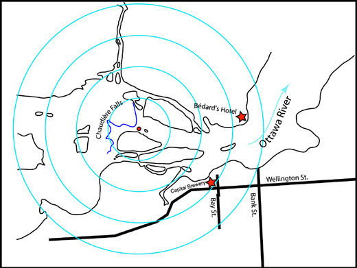
Figure
3 Map of the Immediate
Area Around Chaudière Falls. Map
adapted from W.A. Austin & Co. “Plan of the City of Ottawa shewing
the
position of the buildings available for legislative & departmental
accommodation”, 1858. This adaptation
shows the approximate location of Bédard's Landing and the
intersection of Bay
and Wellington Streets in Ottawa with the location of the Capital
Brewery that Sowter referred to in his articles. The
map is overlain with concentric ¼ mile radius circles centered
on a point well
below the foot of the Chaudière Falls.
|