
Introduction
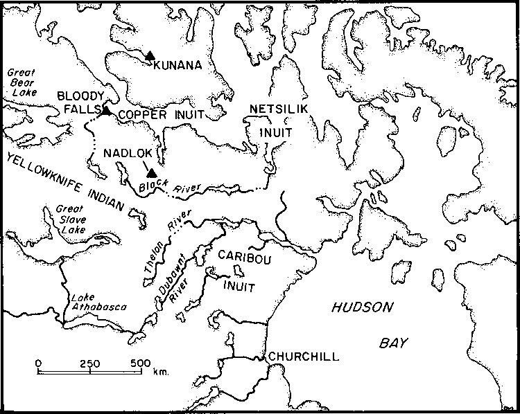
Nadlok or "crossing-place-of-deer" is an island water-crossing on the Burnside River in the Mackenzie District of northern Canada (Figs. 1 & 2). Located on the main migration route of the Bathurst caribou herd, Nadlok is in the centre of a gently sloping basin of open tundra commanding a magnificent view in all directions. Up and downriver are two crossings presently used by the herd and presumably heavily used in the past. The upstream crossing is narrow with fast water but no rapids, an ideal place for kayakers to tire and lance caribou by making them swim against the current. The downstream crossing has wide shallow rapids entering a deep, easily crossed pool. During site excavations in July of 1985 and 1986, herds of up to 30,000 caribou used both crossings.
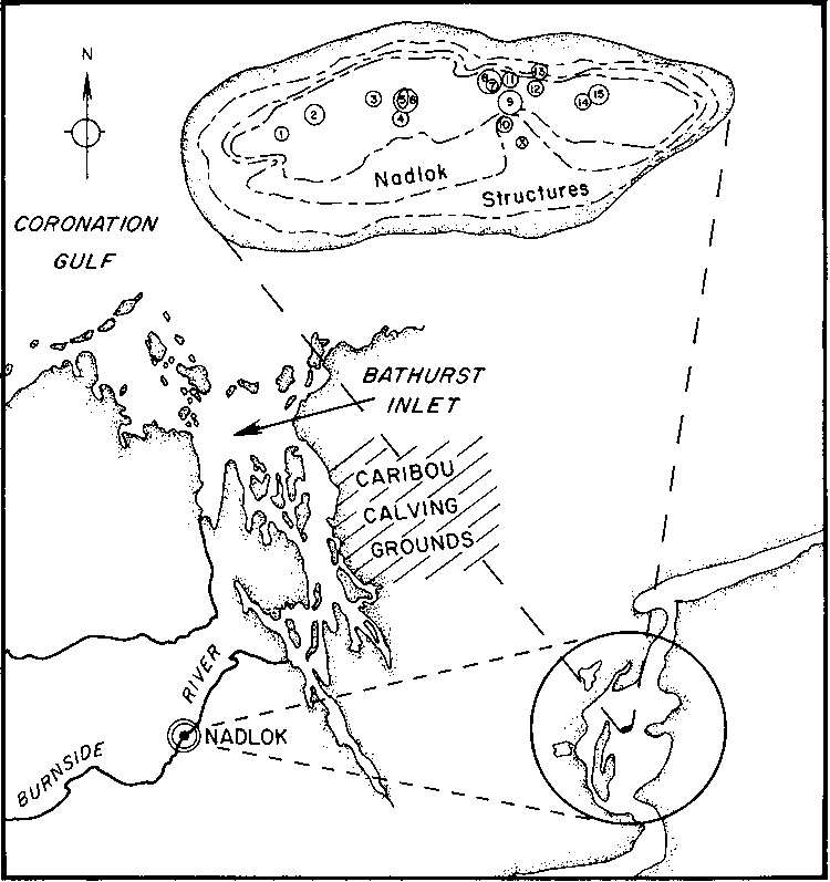
Caribou bone and antler blanket the island and pave the shallows around it, paving the river bottom as far as visibility permits. Bones were also found buried in our food cache, post holes and test pits. Caribou gave the people of Nadlok a huge supply of meat, which was probably dried by draping strips over racks of antler rather than wood because the forest is far to the south. Nadlok's openness and constant northwest breeze facilitated meat-drying in a relatively insect-free environment. Caribou also provided skin clothing, hut covers, sinew for sewing, and bone and antler tools. Such heavy use is expected in a people dependent upon one animal, but at Nadlok antler was substituted for wood in building huts, as seen in five collapsed partly buried 5 m diameter rings. Two antler rings 25 m apart were dug and plotted using a string grid and overhead bipod photography.

Figure 1 Location of Nadlok and other archeological sites
(View a larger version of the map)
Each ring contained hundreds of intertwined antlers, most with adhering skull fragments showing the male caribou did not shed their antlers but were killed while crossing the river. As female caribou cast their antlers in June at the Bathurst Inlet calving grounds to the northeast, the rarity of female antler at Nadlok suggests late summer to autumn hunting.
Clearing revealed a flagstone floor within each ring, while digging showed new rings encircling deeper floors, each progressively smaller than the one above. The uppermost rings (floors 1 and 2) of the second hut contained 1167 and 1006 antlers, each enclosing an area of 8 sq.m. The third ring had 328 antlers, while the bottom ring with only 170 antlers enclosed a floor of only 4 sq.m. The first hut was similar. The rings and floors suggest a superimposed series of antler-walled beehive shaped huts likely roofed with caribou hide.
Each doorway is a metre-wide break in the ring outlined by two upright stones. Extending outward about a metre is a flagstone patio leading to a Thule semi-subterranean stone house. Each house is only 2 m by 3 m, but has a stepped entrance passage and lateral sleeping platform. Separating each house from the lake is a second lower paved area used for outdoor activities and kayak storage.

Figure 2 The Nadlok site
(View a larger version of the map)
Nadlok has five pairs of antler huts and stone houses, with a trail joining their patios. At the east end of the island are four separate unpaved tent-rings (Fig. 2). Stone house 2 and its hut were excavated in 1985 (structures 4-5), while stone house 3 and its hut were dug in 1986 (nos. 7-8). Structure 6 is a simple round wall built using structure 5 stone. Unexcavated stone houses include structures 3, 9, 12, 14 and 15, while undug antler huts include structures 2, 11 and 13. Structures 14 and 15 at the east end of the island are big deeply-inset boulder tent-rings without antlers.
The floors of huts 2 and 3 tilt due to summer thawing of supporting frozen sand and silt. As they tilted away from their stable doorways resting on the rocky island spine, they were levelled by adding flagstones of varying thickness, creating a wedge-shaped profile of southward thickening floors, each a separate occupation. Under the turf, huts 2 and 3 had 3 and 4 floors, respectively, with many subfloors separated by thinner flagstones. Where possible, charcoal samples were collected from each floor for radiocarbon dating.

| Previous Page: Abstract | | | Table of Contents | | | Glossary | | | Next Page: Climate, Dating, and Seasonality |