Giant Image of Canada Installed
Development of the new Canadian History Hall has just taken another major leap forward with the installation of a giant map of Canada, as seen from space.
Positioned on the floor at the centre of the Hall — the Hub — the map measures 15.5 x 9.5 metres and is made up of satellite imagery provided by the Canadian Space Agency (CSA), resulting in a walkway that is truly out of this world.
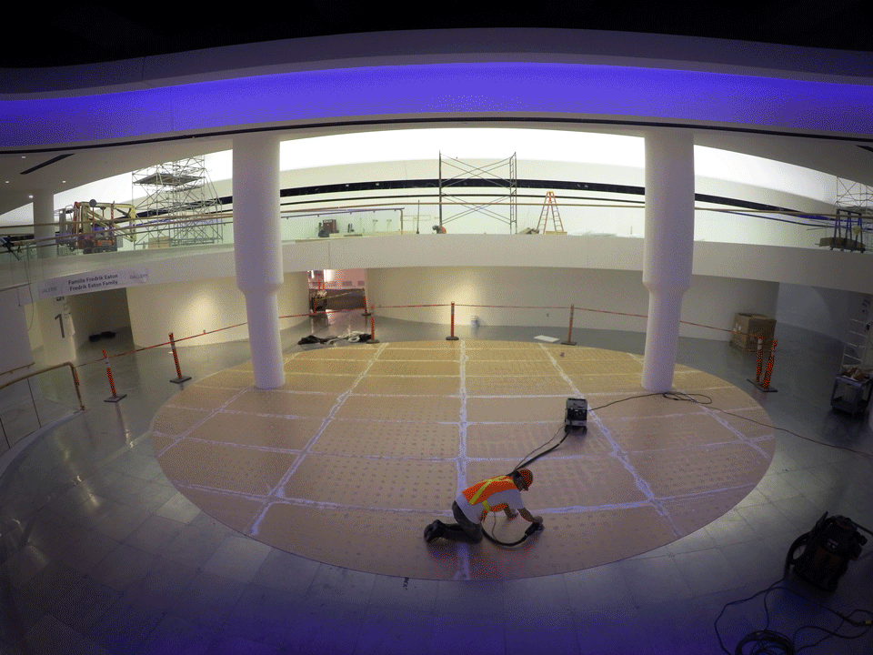
Installation of the giant map of Canada on the Hub’s floor.
Although not created specifically for the Canadian History Hall, when the CSA learned that the Museum hoped to feature an imposing representation of Canadian territory within the Hub, the Agency suggested this cutting-edge view of our country.
The map was originally created in 2013 and was the first satellite image of Canada of its size and scope to be made using RADARSAT-2. Since 2014, it has been used by students and teachers across the country as part of an educational program developed by the CSA and the Royal Canadian Geographical Society, in partnership with the Canada Science and Technology Museums Corporation.
Some specific challenges
There were a few challenges involved in the production of this composite view of Canada. The entire map is actually a mosaic of 121 satellite images captured by RADARSAT-2. To correctly assemble the map, the CSA had to know the precise location of the satellite when each image was taken.
The main challenge was to acquire each image without interfering with other satellite operations. Because the satellite is tasked with a wide range of functions by various government bodies, the CSA had to jump on any vacant window of opportunity, however small, to take a “snapshot” when the satellite was passing over an area not yet imaged. Moreover, because satellite images reflect what’s actually taking place on Earth, it was important to make sure that the images were all acquired at about the same time of year. Fortunately, the CSA managed to avoid seasonal variations by covering all parts of the country during the month of May 2013, making for a more realistic and homogenous end product.
Needless to say, as the central nexus of the new Canadian History Hall, the Hub is going to be a heavy traffic zone. To make sure that the image remains vibrant for years to come, it has been printed on the type of reinforced vinyl commonly used for sidewalks and roads.
Whether viewed close-up or from a vantage point one floor above, this stunning map has captured features from sea to sea to sea. Perhaps this is only fitting given that, when it opens on July 1, 2017, the Canadian History Hall will share the compelling story of the land beneath our feet, from the time of its earliest arrivals 15,000 years ago to the present day.
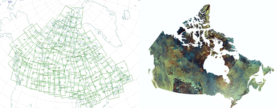
Before and after: The final image is made up of a mosaic of 121 images acquired by satellite and stitched together.
Credit: RADARSAT-2 Data and Products © MacDonald, Dettwiler and Associates Ltd., 2014. In collaboration with the Canadian Ice Service. All Rights Reserved. RADARSAT is an official mark of the Canadian Space Agency.