Canadian Airmail Routes During the Late 1930s
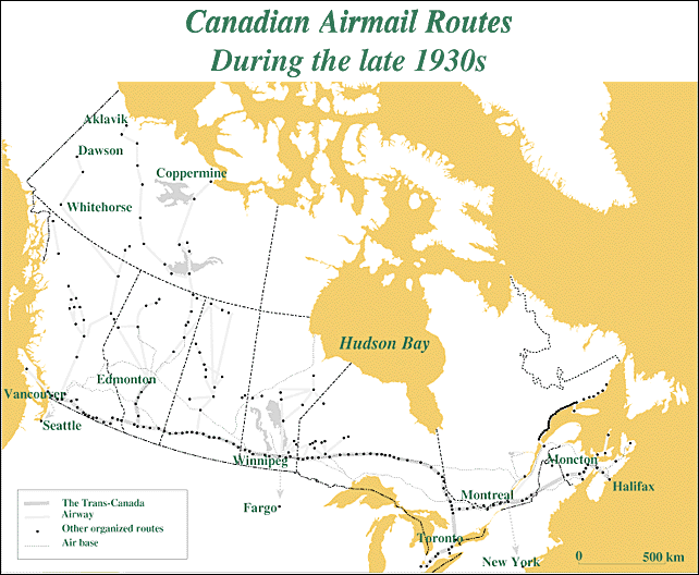
Canada's airmail system was implemented in discrete regional chunks during the late 1920s and the 1930s. The resulting map of airmail routes looks like an inverted T. A main east-west trunk line, known as the Trans-Canada Airway, runs from coast to coast in the southern part of the country, and consists of an interlocking network of public airports, intermediate aerodromes and emergency landing fields. A series of secondary north-south feeders run at right angles to the main line. This geography of the inverted T contrasts sharply with the denser cross-hatched patterns of the U.S.A. and Europe. Airmail service in Australia, by comparison, seems far more focused on the perimeter, as if to avoid the no man's land of the outback lying in the centre of the country.
(Sources: R.E.G. Davies, History of the World's Airlines, 1964; P.J. Hugill, World Trade Since 1431, 1993; "Carte des lignes aériennes..." in I. McQueen, Les griffes "jusqu'à" de la poste aérienne, 1993; "Canada Airmail Routes," Commercial Aviation, March 1939.)
|