FULL TOUR
A Change of
Address - SITE CHARACTERISTICS
Parc Laurier had much to
recommend it. By far the biggest of the five sites, it had some
9.6 hectares (24 acres); although, to escape the risk of the
river flooding, not all the site was useable for building. It is
bounded by Laurier Street, on the ceremonial route, on its
western side; across the road from the south-west corner stands
the Maison du Citoyen. Frontage here is 405 metres (1328 feet).
On the south side was Eddy Forest Products (now Scott Paper
Limited). At the other end of Parc Laurier is the adjacent Parc
Jacques Cartier, linked by a pedestrian pathway; this is
recreational parkland, equipped with a marina. Soaring over the
boundary between the two parks is the Alexandra Interprovincial
Bridge, a plaqued heritage structure; it is like a great
ceremonial arch over one river entrance to the Core Area,
linking CMC with the National Gallery at its other end.
CMC's site is bounded by a pulp products
factory, downtown Gatineau, the Alexandra Provincial Bridge, and the
Ottawa River, all of which have a story to tell in the history
of the National Capital.
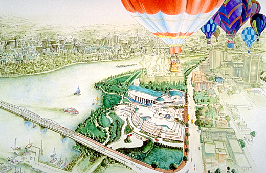
Illustration by Marc Lincourt
© Canadian Museum of Civilization, CD95-720-093
|
The 'jewel in the crown' is the eastern boundary, facing onto
the Ottawa River. The low-lying park slopes gently down to the
river across a depth whose median is 235 metres (770 feet); the
slope is about 5.5% from Laurier Street, which is at an
elevation of 53.5 metres, to the river, at an elevation of 41
metres. The high-water level (47 metres, based on a worst-case,
100-years recurrence) means that almost half the depth of the
property is vulnerable to flooding; but this still leaves room
for a sizeable building. The direction of the slope guarantees a
sunny exposure, especially in the morning. More significantly it
provides a sweeping panorama of the river and the Ottawa side of
the Core Area.
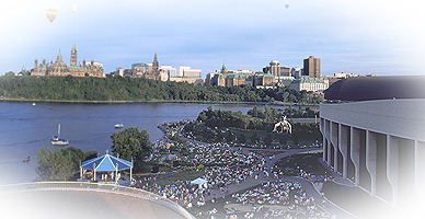
Crowds of thousands can gather in the
riverside park to watch events such as the Canada Day fireworks,
performances on a temporary riverside stage, or events on the
river itself.
© Canadian Museum of Civilization, T2004-225, CD2004-1378
|
Parc Laurier is quite well served by physical access routes.
Principal vehicular access is off Laurier Street, linked by
bridges with either side of downtown Ottawa. A pedestrian and
bicycle path cuts across the park, at the river-edge, and
connects to trails which not only circle around the river in the
Core Area but also network outwards in several directions across
Ottawa and Gatineau. Both these and the ceremonial route itself
link up a series of green spaces developed for the public
adjacent to the city's watercourses. Parc Laurier is one such
space. Although the building of the museum resulted in some loss
of parkland, the park was very underutilized, nor was there any
significant vegetation there to be lost.
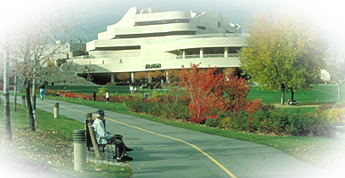
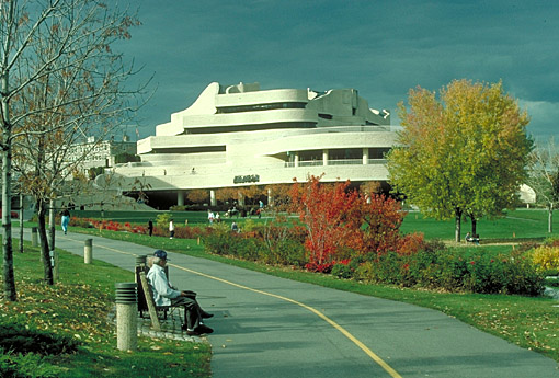
The museum as seen from the river-edge
path.
© Canadian Museum of Civilization, CD2001-59-051
|


|